Making Sense of Original Texas Land Survey Measurements
When I began my early research on Trammel’s Trace back in 2004, I quickly discovered the wealth of information contained within the Original Texas Land Surveys (OTLS) archived by the Texas General Land Office.
There are dozens of original surveys across the eight East Texas counties crossed by Trammel’s Trace which the surveyor calls the old road. A survey “call” is a detailed placement. The surveyor also provided a measurement that defined precisely where the road crossed a survey boundary. Those measurements are expressed in varas.
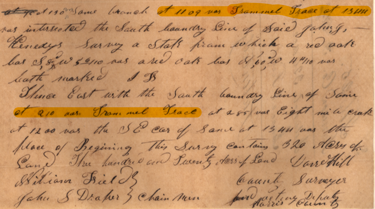
Survey Notes calling Trammel’s Trace. Isaac N. Fields survey, Harrison County, A-260.
To make a long story short, in order to plot those known locations of Trammel’s Trace on a map, I had to convert the measurements in varas to feet. In other research, I am converting the area measurements in labors and leagues to acres. To make that easier for me, and for some of you, I created a Land Measurements Spreadsheet for Texas survey calculations. You can download it free in the Orders section of the spreadsheet. To see how I’ve used these tools go to https://garylpinkerton.com/trammels-trace-maps for more information.